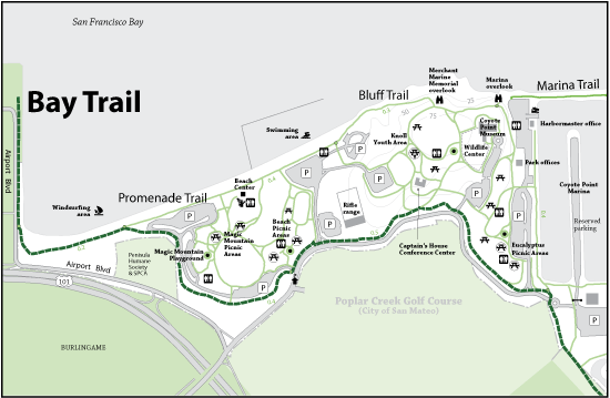


Please note: The trails section of the Coyote Point website is currently being updated to reflect changes made to the park trail system. Some of the maps and information below may be incorrect. See our current map or brochure for better information.
A small piece of a large multi community trail that extends through most of the peninsula cities bordering the San Francisco Bay. You can start at Coyote Point and travel many miles north or south of the park offering hours of uninterrupted views of the bay and its diverse wildlife. The Bay Trail within Coyote Point extends from the southern entrance by the Yacht Club near the Marina along Coyote Point Drive with views of Popular Creek Golf Course towards the Windsurf Beach at the north entrance to the park.
Open to: Accessible, Bicycling, Dogs Allowed On Leash, Hiking
Surface:Paved
Length:
Easy
Elevation Change:
