The County of San Mateo developed the Pest Detection and Trapping Intelligence Platform to modernize how invasive pest monitoring is managed in the field and reviewed by program staff.
Built through a collaboration between the Technology Services Department GIS team and Agriculture, Weights and Measures, the platform replaces paper heavy workflows and delayed data entry with a connected mobile and web based system. Field staff use ArcGIS Field Maps to create and update trap and host records while working in the field. Supervisors and program managers use an ArcGIS Online dashboard to review activity, edit records, export data, and monitor program operations in near real time.
The platform supports regulated trapping workflows and California Department of Food and Agriculture program requirements. It is currently used for the Pest Detection and Invasive Shothole Borer programs and supports the placement and monitoring of approximately 600 traps. The system also brings together nearly 28,000 historical host records and 2,700 historical trap records in one operational environment.

In 2026, the Center for Digital Government recognized the County of San Mateo’s Pest Detection and Trapping Intelligence Platform as a Government Experience Award project winner. The GovX Awards recognize governments using technology to improve service delivery, make information easier to use, and create more effective digital experiences.
The platform improves daily operations by giving staff one authoritative source for trap IDs, routes, grids, historical records, and field activity. Offline maps help staff continue working in areas with limited connectivity. Smart form calculations reduce manual entry for addresses, trap IDs, quotas, route names, and grid assignments. Warning based rules alert staff to possible issues, such as duplicate trap placement, without blocking field decisions when conditions require flexibility.
The system also strengthens compliance and reporting. A nightly automation archives changed records, and daily user level summary reports support review, printing, signature, and submission to CDFA.
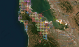
The Pest Detection and Trapping Intelligence Platform has improved how the County collects, reviews, and manages pest trapping data. Staff can now enter information directly in the field, supervisors can review activity through a shared dashboard, and program managers have better access to current and historical information.
Key results include:
- Replaced paper notes and delayed data entry with a connected mobile and web workflow.
- Supported approximately 600 active traps across multiple pest programs.
- Centralized nearly 28,000 historical host records and 2,700 historical trap records.
- Improved field data quality through smart forms, shared map layers, and warning based business rules.
- Supported work in low connectivity areas through offline mobile maps.
- Improved regulatory readiness through nightly archiving and daily user summary reports.
- Created a scalable model that can be adapted for other inspection, monitoring, and asset based field programs.
By combining GIS, mobile field collection, dashboards, and lightweight automation, the platform gives County teams a practical tool for protecting local agriculture, urban landscapes, and ecological systems from invasive pests.